

New heights for 3D reality capture
Is this your challenge?

How to get to new heights when it comes to gathering BIM data quickly and safely? Often, industrial sites can be complex and present intricate geometry. To get that bird’s eye view, some will do it the hard way, deploy from multiple points, run multiple surveys and sometimes use multiple technologies to cover an entire building with high degrees of accuracy. Some will know there is a better way, and that drones are the systems to move forward with.
Now, flying a drone to capture reality from the skies might sound easy. When you think about it, find me a good pilot, give him/her a drone with a good portable scanner stuck on it and we’re good to go.
Well… if you are a natural flight path planner, you can keep your distance for ideal scanning, avoid obstacles, keep steady hands to withstand winds and capture large structures, indoors or outdoors, without missing an inch… congratulations, you do have the job.
For everybody else, there is another ideal candidate that we found out about.
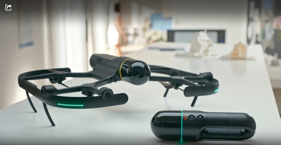
Rarely have we at inTechBrew seen such an advanced solution to gather BIM data for industrial sites. It does what other drones can do but with panache. Safer, faster, cheaper, with good looks, with an award-winning laser scanner and the next level in data fusion out-of-the box: here is the world’s first fully integrated autonomous flying laser scanner and it is an absolute must-have for reality capture in areas you once thought were impossible to scan.
inTechBrew’s insight
Revolutionising the world of measurement and survey for 200 years, Leica Geosystems, part of Hexagon, creates complete solutions for professionals across the planet. Their award-winning Leica BLK Autonomy sensors make your job easier, faster, safer, and give you the data you need right away. The BLK2FLY does just that as the world’s first fully integrated LiDAR UAV.
At inTechBrew, we love the BLK2FLY. For us, it certainly has 2 main strengths to bulldozer the competition.
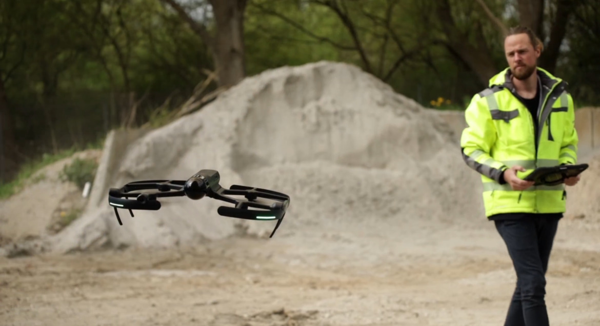
Firstly, the drone’s laser: this is an award-winning technology created for the ground, and very successfully integrated on a small flying device (60 x 53cm) to allow the digitization of hard-to-reach environments. Scanning at more than 420,000 points per second, you can quickly recreate buildings or other structures in 2D or 3D. This extremely large number of points gives a high density of data points to reconstruct spaces very accurately, quickly and safely.
Secondly, its autonomous ability: the integration of advanced obstacle avoidance systems and sensor fusion of LiDAR, radar, cameras, and GNSS, allows the scanner to fly in complete autonomy, therefore allowing the surveyor to save a lot of time by automating his missions.
There is a lot more going for the BLK2FLY and it is overall a great solution to scan areas you once thought were impossible to scan. All that with unmatched performance and minimal or no human intervention required. The best way to capture entire buildings and large environments – and it’s remarkably easy to use.
User case 1: Digital terrain model
CEPSA, Digital terrain model (DTM) for new pipeline expansion
.
Huelva, Andalusia, Spain, 11/2022
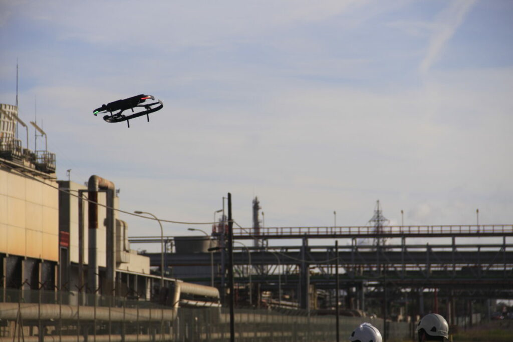
CEPSA, Compañía Española de Petróleos, S.A.U. (Spanish Petroleum Company), is a Spanish multinational oil and gas company. Planning a new pipeline at its La Rábida Energy Park, based in Andalusia, Spain, they knew that using traditional surveying techniques to map their current facility would be costly, time-consuming, and complicated.
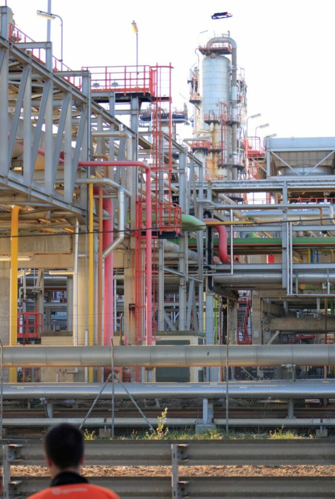
The project scope was two-fold. The first was to create a digital terrain model (DTM) of the area where the expansion is planned, getting precise measurements of existing racks and piping, as well as other existing structures that needed to be accounted for and to plot out the design and course of the new pipeline safely and efficiently. This work consisted of taking data in different areas of the chemical pole, such as areas adjacent to the perimeters of the industrial site, process line racks at different levels that cross the roads from one end to the other and plots with large surfaces in the southern part of the port area.
The second was to see if BLK2FLY would be an ongoing, instrumental part of Cepsa’s future engineering planning.
Both tests were passed with flying colours.
The BLK2FLY was hence employed for the imaging and made it possible to scan the area much more quickly than if conventional techniques or aircraft with different characteristics to the one used had been deployed.
One of the advantages of the BLK2FLY was that the technicians could not only control the BLK2FLY from an iPad, but also receive real-time data during the scans with intelligent battery swapping to ensure almost uninterrupted flight during each of the scanning sessions.
The capabilities of the BLK2FLY were truly tested here, with exposure to high temperatures, prolonged use of the system, continuity of work execution allowed by the change of batteries without stopping missions, execution of manual flights in those areas where it was necessary to adjust the taking of details according to the client’s requirements…
CEPSA has emphasised that the introduction of 3D laser scanning improves and simplifies measurement and documentation in industrial plants. The BLK2FLY is going to make the work in the CEPSA’s Projects department much easier, because of the speed with which they will be able to have 3D models to work on new designs and modifications. It certainly facilitates the mapping of areas that are difficult to access, such as tank areas, giving quick scans for first designs and topographic surveys.
“The cost and time savings were huge” said Patricia Chacón, Cepsa’s Piping Manager. “Moreover, a static scanner project for the same area would take no less than five times as long, and we wouldn’t get the aerial point of view. The level of detail in those upper areas was very important to this project.”
One of the big benefits of the BLK2FLY for the purposes of this project is that it this drone-mounted laser scanner does not require significant technical expertise to fly. It’s truly a fully integrated flying LiDAR scanner, perfect for survey missions with real-time data during scans and smart battery swapping to ensure near continuous flight during each of its scans. It also offers the ability to create set autonomous mission paths via the BLK2FLY Live app to plan the extraction of land data smoothly and efficiently.
“Given the definition of the terrain, we chose high passes at a moderate distance, thus maximizing performance but without exceeding the required precision limits in the case of the tracks [where pipe was to be laid]. So, we combined autonomous flight with manual zigzag flights to densify the areas that were less covered. Thanks to the preview of the point clouds in real-time from the BLK2FLY Live app, we were able to ensure that the point cloud coverage was as expected for the measurement”, says Eduardo Carrasco Álvarez, Assistant Project Manager and Head of the Drones Department at La Linea Vertica, Cepsa’s scanning partner.
For the more constrained sections of the survey, the team took over controlling the BLK2FLY manually via the app to capture all the angles necessary for the proper planning of the project. Keeping the obstacle avoidance option turned on, they managed the survey with no collisions with structures or elements, even outside their field of vision.
User case 2: Scan-to-plan workflow
Hexagon, Vorwerk Wupper, 3D and BIM models.
Laaken, Wuppertal, Germany, 2022
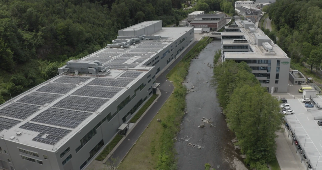
The Vorwerk Wupper Süd in Laaken, Germany, is a family-owned company with more than 130 years of history. They create and produce high-quality appliances such as Thermomix. Their two new facilities, an engine plant with 23,000 m2 and a research facility with 17,000 m2, were used to create a digital twin so to help further enhance their engineering and production capabilities workflow.
A team of architects was hence asked to create a digital twin of both buildings. They started with the exterior of the Vorwerk Wupper Süd and planned the flight path of the BLK2FLY with the mobile application. Some parts of the exterior were scanned manually to ensure nothing was missed, and there was no need for a second scan. Both buildings were autonomously captured in 12 flights, taking them only four hours to complete. To add details, they scanned the interior and parts of the landscape around the facilities with the BLK2GO handheld scanner.
To do so, they used the BLK2GO based on their experience from previous projects. In addition, they chose to use the BLK2FLY to scan the exterior. “I could scan the interior with the BLK2GO by simply walking through the building and capturing the entire facility in high resolution. Its size (the scanner) allows you to capture even very tight spaces. And the live tracking function of the BLK2GO mobile application is great, as it allowed me to see my progress and check if everything necessary was scanned.”, says the architect. It took less than 5 hours to scan both facilities completely, using only two people.
The next step of the Scan-to-Plan workflow is to process the captured data and create the deliverables. Once imported, the data could be combined into one point cloud of the entire Vorwerk. With the completed scans, the exported point clouds could be processed to create an accurate floorplan of the facilities and a 3D model that can be viewed on a computer and in virtual reality (VR). Within two and a half weeks the floorplan and 3D model were created.
For this project, 2D floorplans and a 3D model were created for the customer, so that they have the data quickly at hand in the future if needed. It makes it a lot easier for upcoming projects to be designed, planned and executed, as the contractors have all the necessary data digitally available. Since this data can be sent directly to the contractor, they have no need to visit the site personally, as they can use the floorplans or even walk through the facilities on their computer or use a VR headset to examine it.
The technology: Leica BK2FLY
The award-winning Leica BLK series of reality capture sensors is designed to democratise reality capture worldwide. From portable and handheld laser scanners to autonomous reality capture, BLK sensors contain powerful technology in simple, elegant form factors that are portable, high-quality, and easy to use. BLK technology accessible to users in many different fields and industries around the world, the BLK series enables reality capture for all.
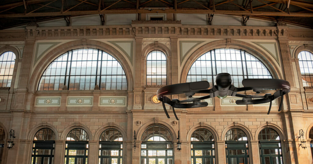
The BLK2FLY, is easy to set up and use, and it can capture entire structures, buildings, facades, and other spaces, both indoors and outdoors, all with a few simple taps on a tablet, and you can take complete control at any time via virtual joysticks in the dedicated BLK2FLY Live App.
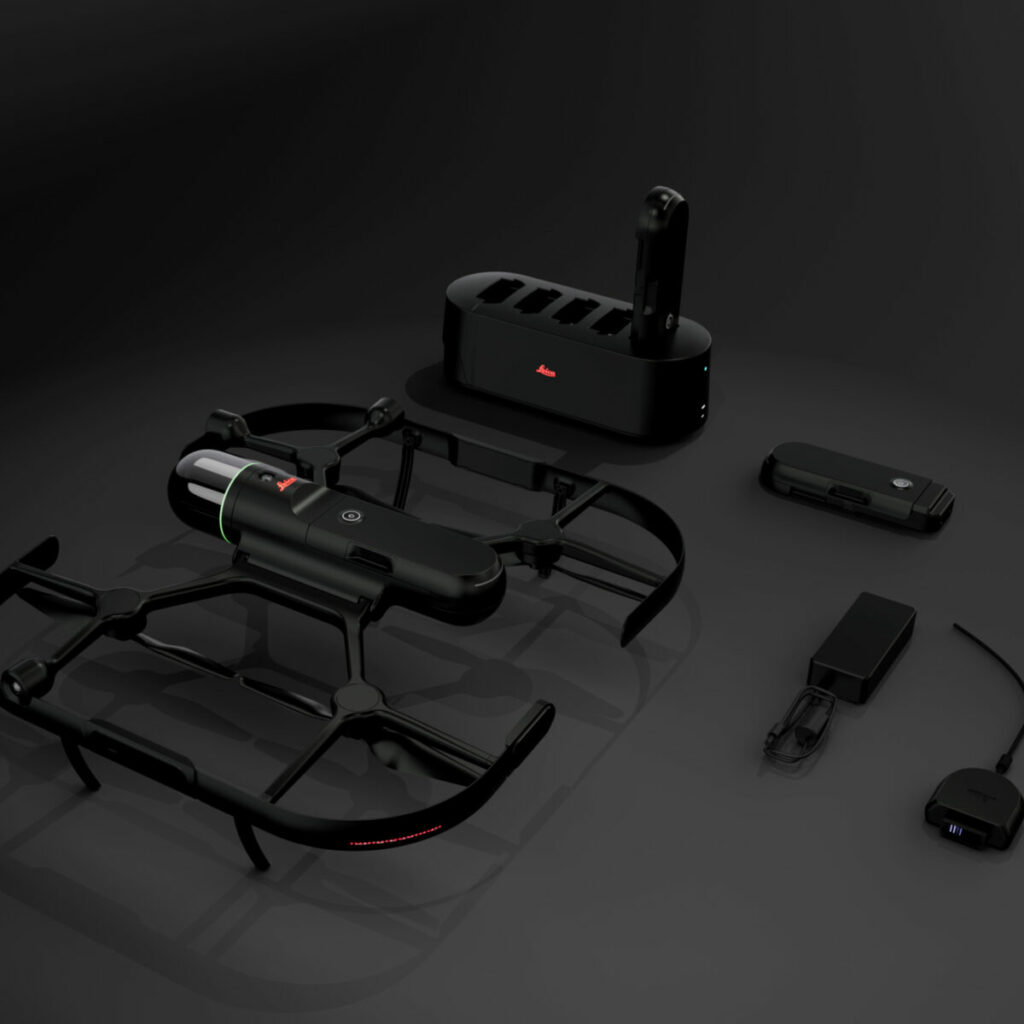
Overall, you get a system that can deal with a very large variety of scenarios. The drone weighs only 2.6 kg, and measures 53 cm by 60 cm. Small and nimble but packing a punch, it is able to withstand winds of up to 12 m/s (more than 40 km/h), which demonstrates its stability. In addition, it has an IP54 protection rating, hot-swappable battery (a single battery will give you about 13 minutes of flying time but the battery can be changed so easily it doesn’t make it a showstopper). It can even fold up for easy transport, and you can store it in a dedicated suitcase that protects it against shocks and bad weather, keeping your equipment safe. It is all backed-up by an easy-to-use app with all the functions you can wish for to achieve successful mapping or detailed BIM.
Do I need to mention the BLK scanner is top-class?
Sensor Fusion
The BLK2FLY uses advanced sensor fusion technology that combines LiDAR SLAM, Visual SLAM, radar, and GNSS for accurate and complete reality capture.
Autonomous UAV Scanning
The BLK2FLY intelligently incorporates the environment around it into its flight plans. It keeps the correct distance for ideal scanning and formulates optimized flight routes for return to home.
Complete scanning with advanced obstacle avoidance
BLK2FLY uses omnidirectional radar and LiDAR to avoid obstacles for accurate, uninterrupted, and safe scanning.
Next generation flight safety technology
No drone experience needed. Simply tell the BLK2FLY where to go and watch it navigate itself safely around obstacles to capture an accurate, uniform scan.
Full Dome LiDAR Sensor
The enclosed, full dome laser scanner onboard the BLK2FLY captures 3D point clouds in all directions.
GrandSLAM
BLK2FLY takes GrandSLAM technology even further. LiDAR SLAM, Visual SLAM, radar, and GNSS make the BLK2FLY fully autonomous, easy to use, and able to fly safely and accurately on its own.
Hot Swap Batteries
The hot swap battery system keeps you flying. The BLK2FLY will return to you during the scan for new batteries and then continue along its mission.
Portability
BLK2FLY is lightweight (2.6 kg/5.95 lbs) and easily folds into a transportation case with all accessories.
Workflows made easy
The BLK2FLY makes it easy to get your data into your preferred software and to share your scans with others. It also works seamlessly with other Leica Geosystems sensors and software.
Virtual Joysticks
You can also pilot the BLK2FLY manually with virtual joysticks on your tablet. This critical safety feature always keeps you in control while keeping the obstacle avoidance on.
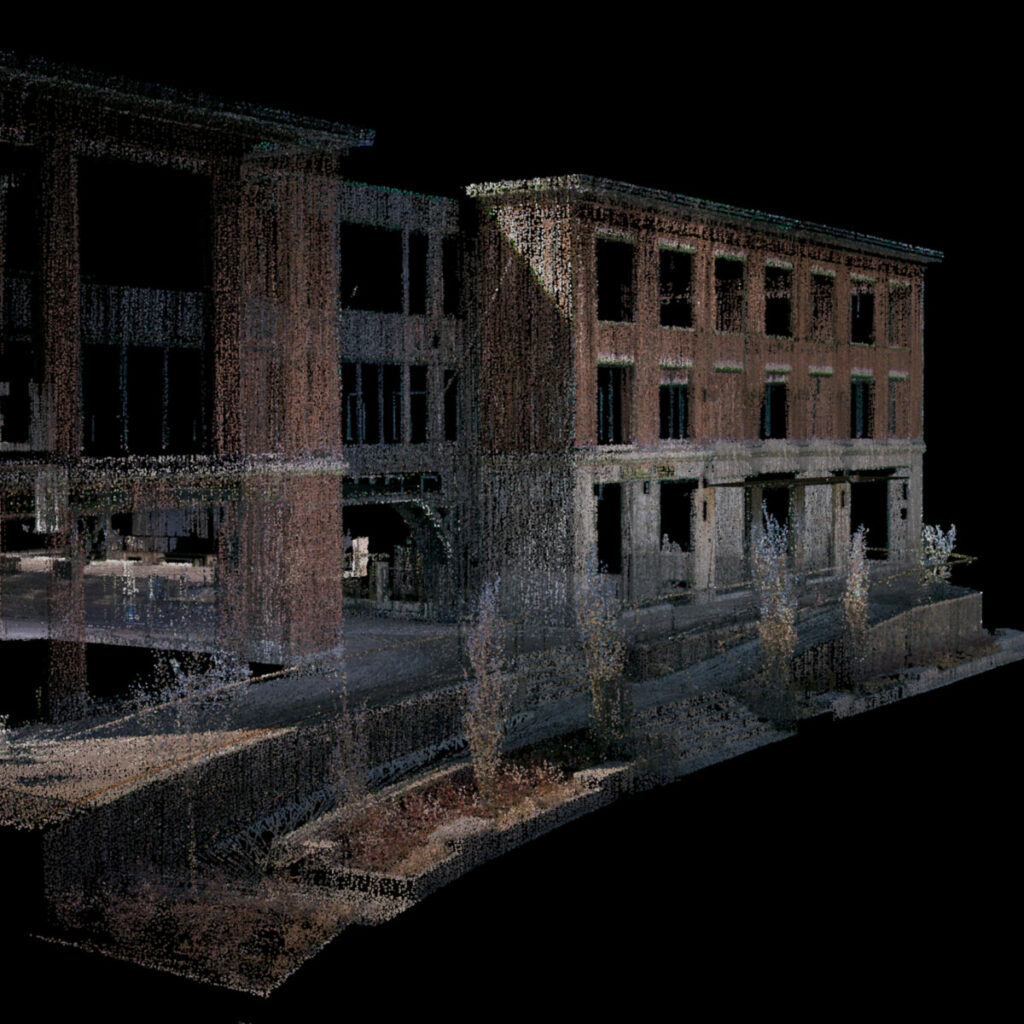
Explore BLK2FLY Data
Check out immersive datasets of digital twins captured by the BLK2FLY from the sky from here. You’ll see how well the scanner captures colorized point clouds with its integrated onboard sensors, including advanced obstacle avoidance and optimised scan and flight paths for complete scan coverage.
| DESIGN | |
| Housing | Carbon and glass fiber frame |
| Dimensions (unfolded) | 53 x 60 x 19 cm |
| Dimensions (folded) | 53 x 32 x 14 cm |
| Weight (incl. battery) | 2.6 kg |
| OPERATION | |
| Remote control | BLK2FLY Live App for iPad supporting LTE connectivity (iOS 13 or later). Including: flight planning, live 2D and 3D visualization, device status, and data management |
| Communication | LTE Bluetooth LE |
| WLAN frequencies | 2.4Ghz access point (flight operation), 5 GHz client (data offload operation) |
| Max. / typical transmission distance | WLAN: ~100m, line of sight |
| Internal storage | 256 Gb |
| Battery | Li-ion 14.8 V, 6.75 Ah, 99.9 Wh |
| LiDAR & IMAGING | |
| Laser class | 1 (in accordance with IEC 60825-1) |
| Wavelength | 83 nm |
| Field of view | 360° (vertical) / 270° (horizontal) |
| Scan range | Min 0.5m – up to 25 m |
| Point measurement rate | 420 000 pts/sec |
| Vision system | 5-camera system, 1.6MP, 300° x 180° total, global shutter |
| SYSTEM PERFORMANCE (SLAM-BASED) | |
| Relative accuracy | <20 mm (concrete/brick surface) |
| Absolute accuracy (w/o GNSS) | 40 mm (4 m distance from object, 2m/s flying speed, 8 min flight, concrete / brick surface) |
| Area coverage: Vertical | 1,550 m2 in 12 min. (0.5 pts/cm2)4,700 m2 in 12 min. (0.17 pts/cm2) |
| Area coverage: Horizontal | 1,350 m2 in 12 min. (0.5 pts/cm2)4,100 m2 in 12 min. (0.17 pts/cm2) |
| ENVIRONMENTAL | |
| Operation temperature | BLK2FLY: +5° to +35°CSmart Battery: +10° to +35°C (Flight start temperature at +5 °C is allowed, once the temperature of the Smart Battery GEB374 is ≥ 10 °C when flight starts.) |
| Storage temperature | BLK2FLY: -10° to +60°CSmart Battery: -10° to +45°C |
| IP Rating | IP54 |
| DATA PROCESSING | |
| Data transfer | Wireless (WLAN & LTE) and USB 3.1 (USB C) |
| Desktop software compatibility | Leica Cyclone REGISTER 360; Leica Cyclone REGISTER 360 (BLK EDITION) |
| Cloud solution | HxDR: Hexagon Digital Reality (direct upload WLAN & LTE) |
| FLIGHT PERFORMANCE | |
| Max speed (no obstacle avoidance) | 5 m/s |
| Max speed (obstacle avoidance active) | 3 m/s |
| Max wind resistance | 12 m/s |
| Max flight altitude above sea level | 1,800 m |
| Flight time | 13 min (400 m above sea level) |
| AUTONOMY | |
| Obstacle avoidance coverage | Full spherical, 360° |
| Obstacle avoidance : min. distance | 4 m |
| Collision avoidance: Undetectable objects | Cables <5mm diameter. Radar does not reliably detect very thin objects like cardboard or small tree branches. It might miss glossy, transparent or dark surfaces. |
Any questions ? Interested in another 3D reality capture solution? Do not hesitate to contact us directly, we will help you find a fit-for-purpose and cost-efficient 3D reality capture solution to answer your challenge.
Leica Geosystems AG, part of Hexagon
Heinrich-Wild-Strasse 9435
Heerbrugg, Switzerland
Phone : +41 71 727 31 31.
E-mail : info@leica-geosystems.com